Interesting spot on the maps, virtual sign seeing on the net.
Sunday, August 30, 2009
National Gallery of Scotland
View Interesting Maps in a larger map
The National Gallery of Scotland, in Edinburgh, is the national art gallery of Scotland. An elaborate neoclassical edifice, it stands on The Mound, between the two sections of Edinburgh's Princes Street Gardens. The building, which was designed by William Henry Playfair, first opened to the public in 1859.
National Gallery of Scotland - Wikipedia
標籤:
Europe - UK
Thursday, August 27, 2009
Rhine Falls
View Interesting Maps in a larger map
View Larger Map
 The Rhine Falls (Rheinfall in German) are the largest plain waterfalls in Europe.[1]
The falls are located on the High Rhine between the municipalities of Neuhausen am Rheinfall and Laufen-Uhwiesen, near the town of Schaffhausen in northern Switzerland, between the cantons of Schaffhausen and Zürich. They are 150 m (450 ft) wide and 23 m (75 ft) high. In the winter months, the average water flow is 250 m³/s, while in the summer, the average water flow is 700 m³/s. The highest flow ehttp://www.blogger.com/img/blank.gifver measured was 1,250 m³/s in 1965; and the lowest, 95 m³/s in 1921.
Rhine Falls - Wikipedia
Tips to experience the REAL Europe, with Rail Europe
Fall in love with the Rhine Falls
Not exactly Niagara Falls, but just as beautiful and breathtaking! The Rhine Falls are a great excursion from Schaffhausen, a city not too far from Zurich. While the Rhine Falls are not known for their height, their width is spectacular. And on a sunny day, the spray from the falls create colorful rainbows. Schaffhausen can be reached from Zurich fairly easily. Travelers can hop on the train to Schaffhausen (approximately 45 minutes). From there, they can walk along the river to Neuhausen (approximately 45 minutes) or take the #1 or #6 bus from Schaffhausen to Neuhausen. From Neuhausen, the Rhine Falls are just a five minute walk - just follow the signs posted along the route. In all, it will take roughly 2 hours.
Friday, August 21, 2009
Olavinlinna
View Interesting Maps in a larger map
 Olavinlinna (Swedish: Olofsborg; literally St. Olaf's Castle, see Olaf II of Norway) is a 15th century three-tower castle located in Savonlinna, Finland. It is the world's most northern medieval stone fortress still standing.
Olavinlinna - Wikipedia
標籤:
Europe - Finland
Kultaranta
View Interesting Maps in a larger map
The Kultaranta (Swedish Gullranda; "Golden beach") is the summer residence of the President of Finland. It is located in the district of Kultaranta on the island of Luonnonmaa, in Naantali. The granite manor house is surrounded by 560,000 square metres of park, belonging to the property.
Kultaranta's original owner was the businessman Alfred Kordelin, who had a manor house built for himself in 1914. It was designed by the famous architect Lars Sonck. When Kordelin died in 1917, the manor's ownership shifted to the University of Turku, and in 1922 the Finnish Parliament voted to acquire it for use as the president's summer residence.
The parks around the manor, containing approximately a thousand square metres of greenhouse and a garden with 3500 roses called Medaljonki ('medallion'), are open to the public. Tours in the garden are organised by the City of Naantali's tourist service.
Kultaranta - Wikipedia
標籤:
Europe - Finland
Seurasaari
View Interesting Maps in a larger map
Seurasaari (Swedish Fölisön) is an island and a district in Helsinki, Finland, known mostly as the location of the Seurasaari Open-Air Museum, which consists of old, mainly wooden buildings transplanted from elsewhere in Finland and placed in the dense forest landscape of the island.
Every summer, many Helsinkians come to Seurasaari to enjoy the rural, peaceful outdoor atmosphere. Despite the visitors, the island has a variety of wildlife, especially birds, but also red squirrels and hares. The height of the island's popularity is at Midsummer, when a huge bonfire (Finnish "juhannuskokko") is built on a small isle just off the island's coast, and ignited by a newly-wed couple. Thousands of people, both tourists and Helsinkians, watch the burning of the bonfire from both Seurasaari itself and from boats anchored near it.
Seurasaari also includes one of only two nudist beaches in Helsinki and one of only three in the entire country. Unlike the other nudist beaches, the beach is segregated for men and women separately with no unisex nudist area.
Seurasaari - Wikipedia
標籤:
Europe - Finland
Saturday, August 15, 2009
Musée d'Orsay
View Interesting Maps in a larger map
The Musée d'Orsay is a museum in Paris, France, on the left bank of the Seine, housed in the former railway station, the Gare d'Orsay, an impressive Beaux-Arts edifice built between 1898 and 1900. It holds mainly French art dating from 1848 to 1915, including paintings, sculptures, furniture, and photography, and is probably best known for its extensive collection of impressionist masterpieces by such painters such as Monet, Degas, Renoir, and Cezanne. Many of these works were held at the Galerie nationale du Jeu de Paume prior to the museum's opening in 1986.
Musée d'Orsay - Wikipedia

標籤:
Europe - France
Friday, August 14, 2009
Kiyomizu-dera (清水寺)
View Interesting Maps in a larger map

Kiyomizu-dera (清水寺?), full name Otowa-san Kiyomizu-dera (音羽山清水寺?) is an independent Buddhist temple in eastern Kyoto. The temple is part of the Historic Monuments of Ancient Kyoto (Kyoto, Uji and Otsu Cities) UNESCO World Heritage site.[1] Not one nail is used in the whole temple. The temple should not be confused with Kiyomizu-dera in Yasugi, Shimane, which is part of the 33-temple route of the Chūgoku 33 Kannon Pilgrimage through western Japan.[2]
Kiyomizu-dera - Wikipedia
標籤:
Asia - Japan
Thursday, August 13, 2009
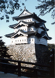
Hirosaki Castle (弘前城, Hirosaki-jō)
 Hirosaki Castle (弘前城, Hirosaki-jō) is a 17th century Japanese castle located in Hirosaki city, Aomori prefecture, Japan. It was constructed in 1611 by the local Tsugaru clan. A three-storied castle tower, fortified moats, castle gates and some corner turrets (yagura) survive or have been reconstructed.
The surrounding Hirosaki Park is one of Japan's most famous cherry blossom spots. Over a million people enjoy the park's 2600 trees during the sakura matsuri (cherry blossom festival) when the cherry blossoms are in bloom, usually during the Japanese Golden Week holidays in the end of April and beginning of May.
Hirosaki Castle - Wikipedia
View Interesting Maps in a larger map
標籤:
Asia - Japan
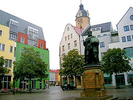
Jena, Home of Zeiss
View Interesting Maps in a larger map
 Jena (German pronunciation: [ˈjeːna]) is a university city in central Germany on the river Saale. With a population of 103,000 it is the second largest city in the federal state of Thuringia, after Erfurt.
At the end of the 19th century, with the building of the railway-line Saalbahn (along the river Saale) from Halle/Leipzig to Nürnberg, Jena became a center for precision machinery, optics and glass making, with the formation of the world famous companies Carl Zeiss Jena and Schott Jenaer Glaswerk, by Carl Zeiss, Ernst Abbe and Otto Schott.
Today Jena is a manufacturing city, specializing in precision machinery, pharmaceuticals, optics and photographic equipment, and is home to the famous Zeiss optics plant. In 1926, the world's first modern planetarium was built by the Zeiss company in the Damenviertel district of the town.
Jena - Wikipedia
標籤:
Europe - Germany
Sunday, August 9, 2009
São Paulo (Saint Paul, Brazil)
View Interesting Maps in a larger map
São Paulo ([sɐ̃w ˈpawlu] is the largest city in Brazil, and is the world's 7th largest metropolitan area.[2][3] The city is the capital of the state of São Paulo, the most populous Brazilian state. It is also the richest city of Brazil. The name means Saint Paul in Portuguese. São Paulo exerts strong regional influence in commerce and finance as well as arts and entertainment.
São Paulo - Wikipedia
Saturday, August 8, 2009
Clevedon Pier
View Interesting Maps in a larger map
Clevedon Pier is a seaside pier in the town of Clevedon, on the English side of the mouth of the River Severn and the Bristol Channel. It is situated next to the Royal Pier Hotel.
The landing stage at the end of the pier is occasionally used by ships, notably the Waverley and her sister ship, the Balmoral, and is a popular spot for angling. There is a cafe at the pierhead, and a souvenir shop at the toll house. The upper floor of the toll house is occasionally used for art exhibitions. The pier is open every day of the year except Christmas Day.
Source: Clevedon Pier - Wikipedia
標籤:
Europe - UK
Perito Moreno Glacier
View Interesting Maps in a larger map
The Perito Moreno Glacier is a glacier located in the Los Glaciares National Park in the south west of Santa Cruz province, Argentina. It is one of the most important tourist attractions in the Argentine Patagonia.
The 250 km2 (97 sq mi) ice formation, and 30 km (19 mi) in length, is one of 48 glaciers fed by the Southern Patagonian Ice Field located in the Andes system shared with Chile. This icefield is the world's third largest reserve of fresh water.
More details: Perito Moreno Glacier - Wikipedia

Friday, August 7, 2009
Lichfield Cathedral
View Interesting Maps in a larger map
Lichfield Cathedral is situated in Lichfield, Staffordshire, England. It is the only medieval English cathedral with three spires. The Diocese of Lichfield covers all of Staffordshire, much of Shropshire and part of the Black Country and West Midlands. The present bishop is the Right Reverend Jonathan Gledhill, the 98th Lord Bishop of Lichfield.
Lichfield Cathedral - Wikipedia
標籤:
Europe - UK
Monday, August 3, 2009
Uffington White Horse
View Interesting Maps in a larger map
The Uffington White Horse is a highly stylised prehistoric hill figure, 374 feet (110 m) long, formed from deep trenches filled with crushed white chalk. The figure occurs on the upper slopes of White Horse Hill in the English civil parish of Uffington (in the county of Oxfordshire, historically Berkshire), some five miles south of the town of Faringdon and a similar distance west of the town of Wantage. The hill forms a part of the scarp of the Berkshire Downs and overlooks to Vale of White Horse to the north. Best views of the horse are obtained from the air, or from directly across the Vale, particularly around the villages of Great Coxwell, Longcot and Fernham. The site is owned and managed by the National Trust.
Info from Uffington White Horse - Wikipedia
標籤:
Europe - UK
Atacama Giant
View Interesting Maps in a larger map
 The Atacama Giant (Spanish: Gigante de Atacama) is a large anthropomorphic geoglyph in the Atacama Desert, Chile. Located at "Cerro Unitas", this is the largest prehistoric anthropomorphic figure in the world with a height of 86 meters and represents a deity for the local inhabitants from 1000 to 1400 AD.
from: Atacama Giant - Wikipedia
Subscribe to:
Comments (Atom)


